The Stilwell Road was called the Ledo Road but renamed after Stilwell at the suggestion of Kuomintang leader Chiang Kai-shek. Ledo, a small town in northern India, is the starting point of this legendary road
Stilwell Road, original name Ledo Road, Highway 478 mi (769 km) long that links northeastern India with the Burma Road (q.v.), which runs from Burma to China. During World War II the Stilwell Road was a strategic military route.
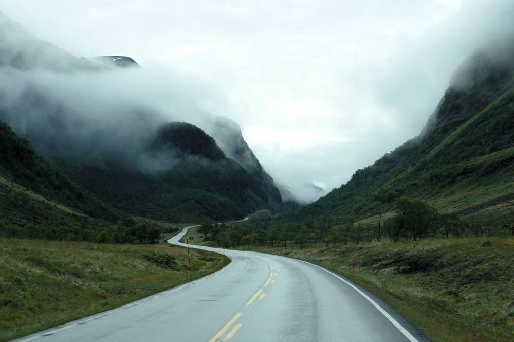
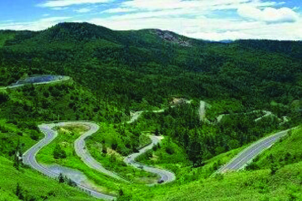
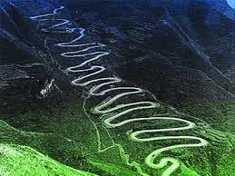
Historic Stilwell’s Road was constructed by the Allied Soldiers lead by America during the Second World War. It started from Ledo, in Assam, India, one of the railheads of the Bengal-Assam railway in the valley of the Upper Brahmaputra, to the Burma Road, which connected to Kunming, China. It passed through Lekhapani, Nmampong and the Pangsau pass on the India-Burma (now Myanmar) border. It wound up the passes of the 9000-foot high Patkai Range and emerged at Shindwiyang and reached Mitkyina. It crosses the broad bowl of the Upper Chindwin, threads the Hukawng and Mogaung valleys, and goes down to Bhamo, eventually connecting to the Burma Road. Much of this road has been reclaimed by the natural landscape, due to lack of maintenance, but portions of it have been and/or are being restored.
Originally named the “Ledo Road”, it was constructed under the direct supervision of American General Joseph Warren Stilwell and was renamed after him in early 1945 at the suggestion of Generalissimo Chaing Kai-shek. General Stilwell was the Chief of Staff to Allied forces in the China-Burma-India (CBI) theatre for the defense of Burma (Mynamar) from Japanese forces. Stilwell technically served under Generalissimo Chaing Kai-shek, Supreme Commander of Allied Forces in China and such parts of Indo-China (now Vietnam) and Siam (now Thailand) as might become accessible to the troops, and in 1943 fell under Admiral Lord Mountbatten who was appointed Supreme Allied Commander of South-East Asia forces. At that time, Stilwell was also appointed Deputy Supreme Allied Commander, South-East Asia forces. However, General Stilwell, as a result of his multiple positions within complex command structures, was able to often break the chain of command, and communicated directly with the US Joint Chiefs of Staff on operational matters.
Earlier, General Stilwell had participated in the First World War and mastered the Chinese language during his extended stays in The Philippines and in China after the war. Known popularly as “Vinegar Joe”, he was known to his troops as “Uncle Joe.”
This project was initially proposed by the British after they prospected the Patkai Range for a road from Assam into northern Burma (Myanmar). It was finally initiated in 1942 after the Japanese had fully captured Burma (Myanmar). With the lines of communication from India to Allied Forces in Burma, and the land route for supplies to the Chinese forces fighting the Japanese in China, both cut, the strategic situation had become critical. The topography of the Indo-Burma border consisted of very difficult terrain, with thick, inaccessible, and Malaria and Dysentery infested forests. The only remaining route for supplies into China was by air, flying a roundabout route over the eastern Himalayas, ”the Hump”, to avoid Japanese fighters based at north Burma. Both the required altitude and the distance impacted fuel usage, severely reducing the number of supplies that could be delivered to China, causing the need to restore a land route to becoming paramount.
It was in the spring of 1942, Japanese forces overran Burma, cutting off the last significant land routes that supplied the struggling armies of Generalissimo Chiang Kai-shek in China.

The United States and its allies extremely needed to keep China in the war because its forces preoccupied hundreds of thousands of Japanese troops. Holding that valuable Chinese turf permitted the Allies to attack Axis powers in the European theater, at the same time building a necessary launch site for an Allied attack on Japan’s home islands. However, that grand strategy could only work if China and allied troops could be routinely supplied.
Flying the Hump: In April 1942, Allied pilots started flying the “Hump,” and continued missions until 1945, when the Burma Road was reopened. The dangerous 530-mile long passage over the Himalayan Mountains took its toll. Nearly 1,000 men and 600 Air Transport Command (ATC) planes were lost over the hump by the end of China-Burma-India Theater (CBI) operations. In addition, China National Aviation Corporation (CNAC) lost 38 planes and 88 airmen. Still now debris of crashed Air Transport planes remnants have been time to time found in and around Assam, Arunachal Pradesh, north Myanmar (Burma) and Southeast China of the China-Burma-India (CBI) theater
General Stilwell’s Operations Officer, Lieutenant Colonel Frank D. Merrill, recommended building a road from Ledo, Assam, India to Burma, connecting the old Burma Road to provide a land supply route into Burma for support of the Allied soldiers who were fighting the Japanese forces in North Burma and China.
Lieutenant Colonel Frank D. Merrill Commanding officer of “the experienced jungle troops, for a dangerous and hazardous Mission – somewhere” lead his specially trained 5307 Composite Unit (Provisional) called “Merrill’s Marauders” to the Ledo Road and started marching on foot from Margherita, near Ledo, India on February 7, 1944 passing through Pangsau Pass (Hell Pass), Shindbwiyang, Jambu-Bam, and then Myitkyina most of the times fighting and struggling against rains, mud, swamps, Malaria, Dysentery, Typhoid and strategically positioned enemies at different locations on their way. Merrill’s Marauders seized Myitkyina air-strip on May 17, 1944, despite strong resistance from Japanese forces. Then after some days later, they captured Myitkyina town itself, which was the stronghold of Japanese forces based in north Burma and the two months campaign ended on August 3, 1944, with Merrill’s Marauders 127 deaths and 291 wounded besides, other casualties. Myitkyina was one of the main missions of Stilwell.

In December 1942, the road construction begun by constructing Warehouses, Hospitals, Barracks and base roads at Ledo, Assam, India side by side fighting with the Japanese forces. On December 16, 1942, Allied forces began building the double-track, all-weather Ledo road. Subsequently, the Americans had brought heavy road construction machinery to these wild hills like Bulldozers, Cranes, Power-shovels, Caterpillars, Steam-rollers, in massive procession from the United State production-lines 12,000 miles away, across two Oceans and past three Continents.
General Stilwell had organized a ‘Service of Supply’ (SOS) under the command of Major General Raymond A. Wheeler, a high profile US Army Engineer and assigned him to look after the construction of the Ledo road. Major General Wheeler in turn, assigned responsibility of base commander for the road construction to Colonel John C. Arrowsmith. Later, he was replaced by Colonel Lewis A. Pick, an expert US Army engineer, as road construction was slowed down under Arrowsmith during the monsoon season of 1943. He had employed some of the finest mechanical roadmakers from Americans, British, Indian, Chinese and West Africans to fight against the wild jungles, tangles of swamp and forest, deep valleys and high cliffs and test of heavy rains and floods across the Indo-Burma Mountain Range.
On December 27, 1943, three days ahead of schedule, the road reached Shindbwiyang Finished grading and graveling remained to be done, but the 117 miles from Ledo to Shindbwiyang were open before January 1, 1944, as General Stilwell wished. Colonel Pick’s celebration for the engineers omitted none of the available essentials. As he congratulated them for opening 54 miles of trace in 57 days, a convoy came rolling into Shindbwiyang with candy, doughnuts, and 9,600 cans of beer.
In late 1944, barely two years after Stilwell accepted responsibility for building the Ledo Road (Stilwell Road), it connect to the Burma Road through some sections of the road beyond Myitkyina at Hukawng Valley were under repairing due to heavy monsoon water, and it becomes a highway stretching from Assam, India to Kunming, China 1,079 miles length. On January 12, 1945, the first convoy of 113 vehicles was led by General Pick from Ledo and was reached Kunming, China on February 4, 1945, and celebrated the achievement. The road construction was estimated to cost 137,000,000 dollars.
Two 4-inch fuel pipelines were laid side by side and followed along the Ledo Road from Tinsukia, Assam, India to relieve the road and air traffics of carrying fuel from Assam, India to China. They were fed by gasoline pumped from Calcutta to a station near their starting point.

On May 20, 1945, newly promoted Major General Lewis A. Pick formally announced the completion of the Ledo road, a task he called the toughest job ever given to US Army Engineers in Wartime. The road was renamed the Stilwell Road in honour of General Joseph W. Stilwell at the suggestion of Chiang Kai-shek, it was known to the Engineers who built it as “Pick’s Pike.”
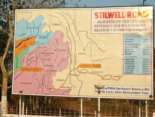
In the course of time, Stilwell Road had virtually disappeared due to the road lies in the lands of three different nations that are China, Burma and India and due to no maintenance by the respective nations. However, 61 km of the road lies in India, 1,033 km in Burma (Myanmar) and 632 km in China. In India out of 61 km, 30 km lies in Assam and 31 km in Arunachal Pradesh. The border between Assam and Arunachal Pradesh has 14 km of the road section previously which was in deplorable condition, now it is repaired and the construction of the international trade route is underway to link Myanmar at Pangsau Pass. In India’s side, the road is being repaired and renovated up to Nampong under this scheme and extension of the renovation work up to Pangsau Pass, Indo-Myanmar border is underway. The section of road which lies within Arunachal Pradesh has been maintained by the Government of Arunachal Pradesh and the road section which lies within the area of Assam out of 14 km has been in maintained by the Government of Assam respectively.
The Indian government has proposed this road for reopening as International Highway for trade routes to link Myanmar (Burma), China and other Southeast Asian countries in its Act East Policy. The reopening of this road as a trade route will increase the interaction between the people of neighboring countries and maintain good relationships among the member countries. It will also boost trades and attracts inland and foreign tourists as the road itself is historically famous and significant due to the Second World War, which in turn will boost Socio-economic development of this most backward border area and will benefit the local people. Northeast India is geographically isolated and the economical development is lacking behind other parts of India due to several factors even though the region is endowed with natural resources. There is already approved trade routes with Myanmar from Nagaland and Manipur and to Bangladesh from Assam and Tripura which is one of the significant means of foreign trade and regional co-operation towards economic development of the region.

Everyone in this area is looking forward for implementation of the Act East Policy project within the stipulated time and hoping the area be established as a major international trade center
Contact: www.dreamwaydestinations.com & www.visittobengal.com Or Call me at +919733465000 & +919474092500 Or WhatsApp : +918617432205
Image may contain: mountain, sky, cloud, outdoor and nature